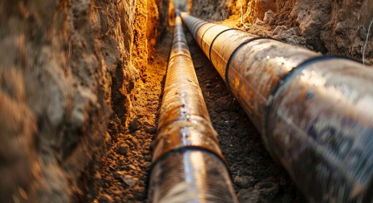
In today’s technologically advanced world, the importance of accuracy in georeferencing and underground mapping for project success cannot be overstated. Precision is the linchpin that holds entire projects together, ensuring safety, efficiency, and cost-effectiveness. Precision matters, particularly in underground mapping, where even minor errors can lead to catastrophic failures. This blog post will delve into why precision is paramount in underground mapping and how it impacts various facets of a project.
The Foundation: Importance of Accurate Georeferencing
Accurate georeferencing forms the bedrock of any successful underground mapping endeavor. Georeferencing involves correlating data to real-world locations, allowing for precise plotting and interpretation of underground features. When it comes to underground mapping, precision is king because even the slightest miscalculation can lead to disastrous outcomes.
Firstly, consider how accurate georeferencing impacts the planning phase. Planners rely on geospatial data to make informed decisions about where to excavate, drill, or lay infrastructure. Without accurate data, these decisions become guesswork, increasing the risk of encountering unforeseen obstacles, such as buried utilities or natural formations. Consequently, this could lead to project delays, increased costs, and safety hazards.
Secondly, precision in georeferencing aids in the seamless integration of multiple data sources. Underground mapping often requires data from various sources, such as satellite imagery, GIS databases, and ground-penetrating radar (GPR). When these data sets are correctly georeferenced, they provide a cohesive and coherent map, enabling stakeholders to make well-informed decisions.
Safety: The Non-Negotiable Aspect
Safety is a non-negotiable aspect in any construction or excavation project. Precision in underground mapping plays a crucial role in upholding safety standards. Misidentification or misplacement of underground utilities, such as gas lines, sewer systems, or electrical cables, can lead to hazardous conditions.
Underground mapping ensures that these utilities are accurately located and marked. This allows construction teams to avoid them, mitigating the risk of accidental ruptures or electrical hazards. Accurate mapping can also identify areas of potential subsidence or underground voids, which pose risks not just to the immediate excavation team but to the broader community as well.
Moreover, precise underground mapping facilitates safe excavation practices by providing detailed information about soil composition, water tables, and other geological conditions. This data is invaluable for engineers who need to design support structures or shoring systems to maintain the stability of excavated areas. Through precision, not only are lives protected, but the structural integrity of the project is also maintained.
Efficiency: The Added Advantage
Efficiency is another significant benefit of precision in underground mapping. Accurate data leads to streamlined operations, saving time and resources. When teams know the exact location of underground features, they can plan their activities more effectively, reducing the likelihood of costly surprises.
In addition, precision in underground mapping allows for better resource allocation. Knowing the exact conditions, materials, and tools needed for a particular task helps in minimizing waste and optimizing labor efforts. This increases the overall efficiency and productivity of the project, leading to timely completion and satisfied stakeholders.
Furthermore, precise underground maps serve as an invaluable reference throughout the project lifecycle. When maintenance or future expansions are required, having a detailed and accurate underground map reduces the need for redundant surveys or exploratory digs, thereby further enhancing efficiency.
Cost-Effectiveness: The Financial Filter
Cost-effectiveness is directly tied to the precision of underground mapping. Accurate mapping not only prevents costly errors and rework but also enhances budgetary control and financial planning. When underground features are precisely mapped, project managers can better estimate costs and allocate budgets, reducing the likelihood of unexpected expenses.
Consider the financial implications of encountering an uncharted utility line that requires rerouting or additional safety measures. Such unforeseen issues can inflate project costs and timelines, straining budgets and causing delays. Precision in underground mapping precludes such scenarios, allowing for more accurate financial forecasting and budget adherence.
Moreover, precise underground mapping can help secure stakeholder confidence and funding. Investors and stakeholders are more likely to commit resources to a project if they are assured of its planning and accuracy. Demonstrating that a project has meticulous underground mapping can be a decisive factor in securing the necessary financial support.
Environmental Impact: The Ethical Angle
The environmental impact is another crucial consideration in underground mapping. Accurate mapping ensures that environmentally sensitive areas are identified and preserved, preventing ecological damage. This is particularly important for projects near water bodies, protected habitats, and areas with rich biodiversity.
For instance, precise mapping can help avoid the contamination of water sources by identifying potential pathways for pollutants. Similarly, it can help preserve root systems and soil health by providing clear guidance on where digging should be minimized. By protecting the environment, precision in underground mapping upholds ethical standards and fosters community goodwill.
Furthermore, environmental compliance is often a regulatory requirement. Accurate underground mapping ensures adherence to environmental regulations, avoiding legal repercussions and potential fines. This makes precision not just a best practice but a legal necessity for environmentally responsible projects.
Technological Integration: The Modern Mandate
In the digital age, the integration of advanced technologies with underground mapping has become essential. Techniques such as LiDAR, GPR, and geographic information systems (GIS) have revolutionized the field, but the key to their effectiveness lies in precision.
Firstly, technologies like GPR and LiDAR offer unprecedented accuracy when correctly calibrated and executed. These technologies can detect minute variations in subsurface materials, providing incredibly detailed maps. However, the output is only as good as the precision with which the data is collected and interpreted.
Secondly, the use of GIS allows for the layering of various data types, creating comprehensive and multi-faceted underground maps. The importance of accuracy in georeferencing and underground mapping for project success becomes evident here, as precise georeferencing allows for the integration of various data sets into a single, reliable map. This facilitates better decision-making and project planning.
Future Trends: The Road Ahead
With advances in technology and an increasing emphasis on sustainable practices, the future of underground mapping looks promising. The trend is moving towards even greater precision and the integration of real-time data.
One burgeoning trend is the use of machine learning algorithms to enhance the accuracy of underground mapping. These algorithms can analyze vast amounts of geospatial data to identify patterns and predict underground features with high precision. This represents a significant leap forward in both accuracy and efficiency.
Moreover, the integration of Internet of Things (IoT) sensors into underground mapping presents another exciting avenue. These sensors can provide real-time data on underground conditions, such as moisture levels, temperature, and movement. The continuous flow of real-time data ensures that maps are always up-to-date, enhancing both safety and efficiency.
The Final Word
In conclusion, the importance of accuracy in georeferencing and underground mapping for project success cannot be overstated. Precision is the linchpin that ensures safety, efficiency, cost-effectiveness, and environmental responsibility. As technology continues to evolve, the emphasis on precision will only grow stronger, making it an indispensable aspect of modern underground mapping.
Sluggish and imprecise methods belong to a bygone era. In today’s competitive and technologically advanced landscape, precision is not just an advantage but a necessity. It is the invisible thread that weaves together the myriad elements of a project, ensuring seamless execution and successful outcomes.


